Watch all the Transform 2020 sessions on-demand here.
One of the big by-products of the digital revolution has been data — large banks of information garnered from billions of connected devices and software. Making sense of all this data is a challenge, but it’s one that San Francisco-based StreetLight Data has been setting out to tackle by drawing meaningful insights from trillions of location-based data points collected from smartphone apps.
Founded in 2012, StreetLight Data works with an aggregator called Cuebiq, which offers app makers an SDK that enables them to request anonymized access to their users’ location data. On an individual user basis, this doesn’t reveal that much, but tracking the location of people through weather apps, dating apps, and around 300 other apps on 70 million devices in North America can serve up valuable insights into how people move around.
StreetLight Data applies its algorithms to this data to figure out things like where people travel to and from, at what times, and on which days. This can be useful for city authorities, engineers, and urban planners working on new infrastructure projects. The data can also reveal how new modes of transport are impacting the way people travel — for example, has a new train line helped reduce traffic jams in a particular area?
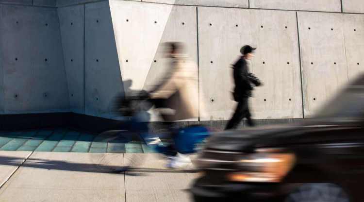
So far, StreetLight Data has focused largely on tracking vehicular traffic — cars, buses, motorcycles, and so on. Moving forward, the company will be expanding the scope of its flagship StreetLight Insight product to cover pedestrians and bicycles.
June 5th: The AI Audit in NYC
Join us next week in NYC to engage with top executive leaders, delving into strategies for auditing AI models to ensure fairness, optimal performance, and ethical compliance across diverse organizations. Secure your attendance for this exclusive invite-only event.
The platform has, of course, already been tracking pedestrians and bicycles, but it hasn’t been able to provide specific breakdowns for these modes of transport. StreetLight Data said it has developed a new proprietary machine learning toolset that can differentiate bikes and foot traffic from motorized vehicles.
Above: StreetLight Data
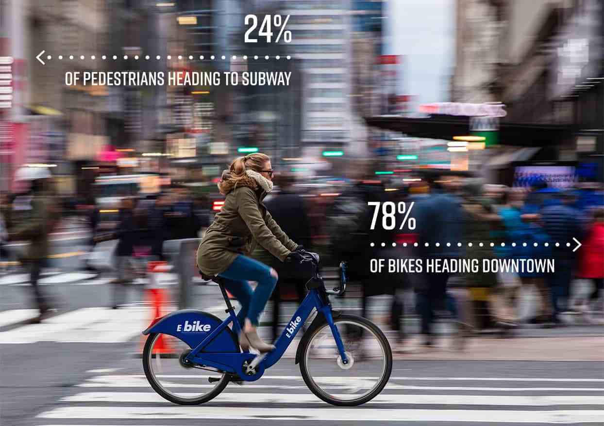
So anyone who subscribes to StreetLight Data can now log into their digital dashboard and view exact times, dates, and trip types (car, bike, foot). From this, they can see things like average travel times and distances per mode of transport during rush hour in a specific street, neighborhood, or any other pre-defined “zone.”
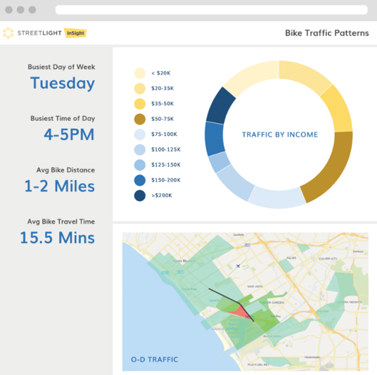
Above: StreetLight Data: Insights
Smart cities
Cities are increasingly turning to tech-infused mobility platforms for access to data. Uber, for example, has partnered with cities to help planners manage urban growth, and last year it joined SharedStreets, a data-sharing project from the National Association of City Transportation Officials (NACTO).
Elsewhere, Palo Alto-based Waycare is collecting historical and real-time data from multiple sources, including connected car platforms, telematics services, road cameras, construction projects, fleet management platforms, weather services, and public transit, to help cities build a more complete picture of their roads.
However, being able to drill down into a specific mode of transport — be it cars, bikes, or pedestrians — arms cities with even more detailed information. If data shows that more than three-quarters of bike traffic is heading downtown, for example, that could be used to justify more cycle lanes.
“My hope is that by being able to measure bikes and pedestrians, we can manage toward a future where these modes of travel are more prevalent,” said StreetLight Data CEO Laura Schewel.
StreetLight Data recently raised $10 million in funding, taking its total amount raised to around $30 million, with a promise to accelerate its expansion and “invest in new product innovations.” Today marks the first step in this expansion.
“StreetLight Data has long led the industry with in-depth analytics that describe the mobility patterns of vehicle traffic,” Schewel added. “It is critical to develop a granular analysis of bike and pedestrian traffic to better see a complete picture of today’s complex mobility landscape. Our industry has been in the dark for years on bike and pedestrian movement because of the cost and difficulty of data collection. Now we can shed light on these mobility trends, giving planners the ability to make smart decisions about policy and infrastructure investment.”