Watch all the Transform 2020 sessions on-demand here.
Self-driving cars rely on a bevy of sensors — including cameras, lidar, and radars — to navigate their complex surroundings. But sight is no substitute for maps, and with over four million miles of roads in the U.S. alone, collecting that data is no small feat. That’s where Carmera comes in.
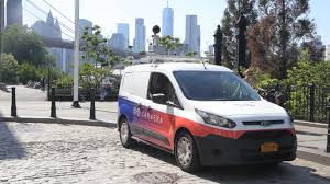
The Brooklyn-based startup, which launched in June 2017 after spending two years gathering three-dimensional maps of New York City with lidar-equipped vehicles, today unveiled a real-time event management engine that facilitates quick, up-to-the-minute updates to said maps.
It also announced a partnership with the City of New York and a $20 million funding round led by GV, Google’s venture capital arm, with participation with prior investors including Matrix Partners.

Above: An animation demonstrating Carmera’s 3D mapping solution.
Carmera’s new and improved platform — which is being deployed in cities including New York, San Francisco, Seoul, and Tokyo — taps a database of crowdsourced, high-definition maps sourced from vehicle fleets to derive insights from construction, police activity, traffic signals, turn restrictions, lane markings, and other events that might “have outsized impact” on ETA and disengagements.
June 5th: The AI Audit in NYC
Join us next week in NYC to engage with top executive leaders, delving into strategies for auditing AI models to ensure fairness, optimal performance, and ethical compliance across diverse organizations. Secure your attendance for this exclusive invite-only event.
“In designing this system, we learned a lot from our customers who are serious about commercial services — not just R&D or PR demos — and were frustrated by standard definition or incumbent mapping solutions that take months or quarters to update a simple feature,” Carmera wrote in a Medium post.
One of those customers is the New York City Department of Transportation, which starting this year will receive historical pedestrian analytics, real-time construction detection, and other mapping data from Carmera. In exchange, the DOT will provide “key city datasets” that’ll help the startup “improve the accuracy” of its street inventories.
“New York City has the most complex street environment in the country, and with continued growth in population, employment, and construction, our streets and sidewalks are only getting busier,” Michael Replogle, Deputy Commissioner for Policy, NYC Department of Transportation, said in a statement. “The ability to collect and analyze high-quality data about pedestrian volumes and traffic events in real time could be very useful in DOT’s work managing our transportation system and designing streets for people. We are exploring a potential data-sharing partnership with CARMERA to see how their tools can support this work.”
It’s an expansion of Carmera’s data-sharing partnership with the Downtown Brooklyn Partnership and New York City Economic Development Corporation’s Urbantech program, and comes on the heels of collaborations with the University of Michigan Mcity and TechLab program, Michigan State University’s CANVAS, and Seoul National University’s AV research initiative.
On the private sector side of Carmera’s business, it recently inked a deal with autonomous taxi startup Voyage that will see it map more than 750 million roads within The Village, a Florida retirement community. And it says it has contracts with “some of the largest” auto OEMs and mobility-as-a-service (MaaS) companies in the world.
“We will continue to forge partnerships that serve our R&D goals and customer demands, and help democratize access to key technology,” Carmera wrote.
Carmera, which was founded in 2015, has offices in Seattle, Detroit, Seoul, and New York City. Past investors include Notation Capital, New York University, the University of Washington, and MakerBot cofounder Bre Pettis.